Analyzing Geolocated data with Twitter
The proliferation of Online Social services and the availability of large scale digital datasets have enabled a new wave of research in social science. This tutorial aims to offer an overview of the opportunities and challenges posed by Twitter with a particular emphasis on its use for the study of human behavior, guiding participants through the entire process of mining such datasets to using them to analyze different aspects of social behavior with a theory-backed approach.
|
|
Instructors Noemi Derzsy Rensselaer Polytechnic Institute
Bruno Gonçalves New York University
|
|


|
WHAT WILL YOU LEARN?
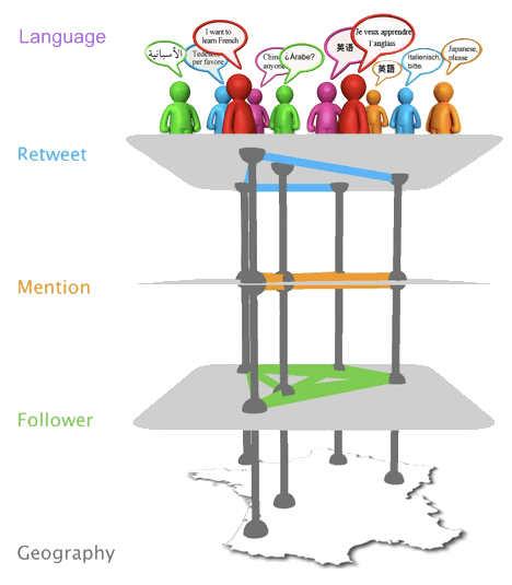
We will explore in detail a Twitter user and language interaction network. Using NetworkX we will measure node and edge properties such as the degree and weight distribution and visualize it in real space using matplotlib Basemap. A comparison with the airline transportation network (from the Bureau of Transportation Statistics) will be performed. Finally, we will illustrate how detailed geographical statistics over arbitrary regions (county, state or country level) using publicly available Shapefiles (from the Census bureau), shapely and geopy.
|

|
